Why People For Nature encourages every Oasis to use iNaturalist
At People For Nature, we believe that protecting nature starts with connection — and that everyday people play a vital role in restoring and understanding the living world around them.
That’s why we encourage everyone creating a Nature Oasis to use iNaturalist: a simple, joyful way to turn your patch of nature into a living contribution to science.
What is iNaturalist?
iNaturalist is a free app that allows you to photograph plants, animals and fungi, upload your observations, and help build one of the world’s largest biodiversity databases.
Your sightings don’t just stay on your phone — they become real data, used by scientists, conservation groups and decision-makers to better understand biodiversity and how it’s changing.
Why iNaturalist belongs in every Nature Oasis
Nature Oases are designed to restore habitat, invite biodiversity back, and reconnect people with the natural world. iNaturalist helps make those changes visible.
By using the app, you can:
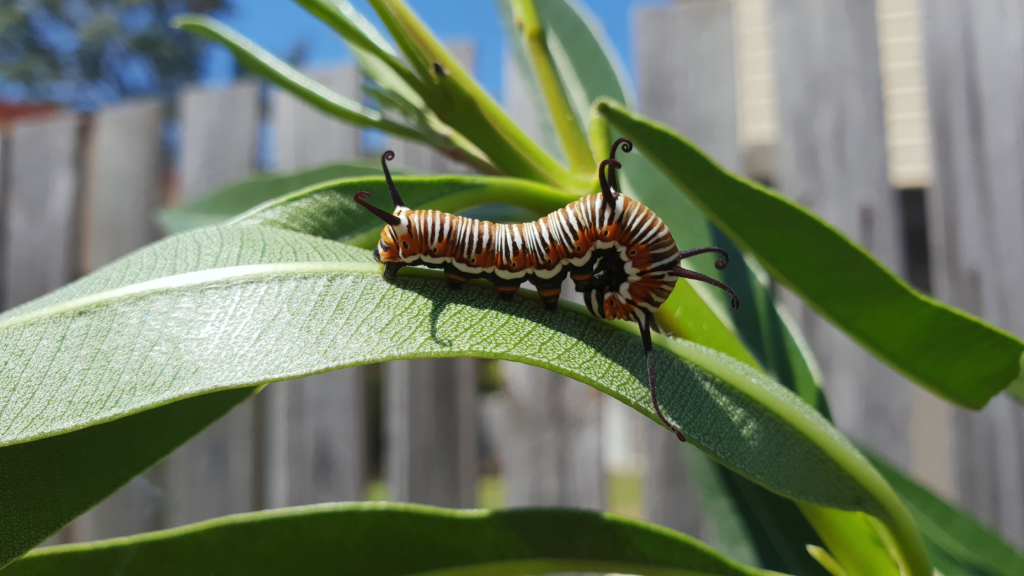
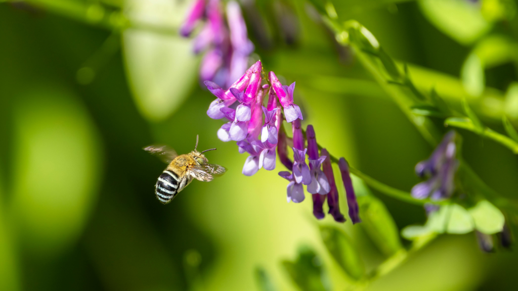
🌿 see what species are already present in your Oasis
🐝 track pollinators, birds and other wildlife as habitat improves
📈 observe changes over time as your Oasis grows and matures
🧩 contribute valuable local data to national and global research
Every observation strengthens the case for nature-positive action — starting right where you live.
Citizen science that’s genuinely fun
You don’t need to be a scientist. You don’t need special equipment. All you need is curiosity.
Using iNaturalist often feels like:
a nature scavenger hunt
a shared learning experience with kids, friends or neighbours
a moment of wonder when you realise how much life is around you
And the iNaturalist community is there to help identify species, answer questions and celebrate discoveries with you.
From individual Oases to collective impact
One Nature Oasis matters. Thousands of Nature Oases? That’s a movement.
When many People For Nature participants use iNaturalist, we begin to:
build a clearer picture of biodiversity across communities
support citizen-led conservation and monitoring
strengthen Australia’s contribution to global biodiversity knowledge
show that people power can make nature visible — and valued
This is climate and biodiversity action grounded in place, care and participation.
How to get started
Download iNaturalist (free on iOS and Android)
Step into your Nature Oasis
Photograph what you see — plants, insects, birds, fungi
Upload your observation and let the community help identify it
That’s it. You’re now part of a global citizen science network — through People For Nature.
Because every Nature Oasis tells a story. And with iNaturalist, we can make sure those stories count.
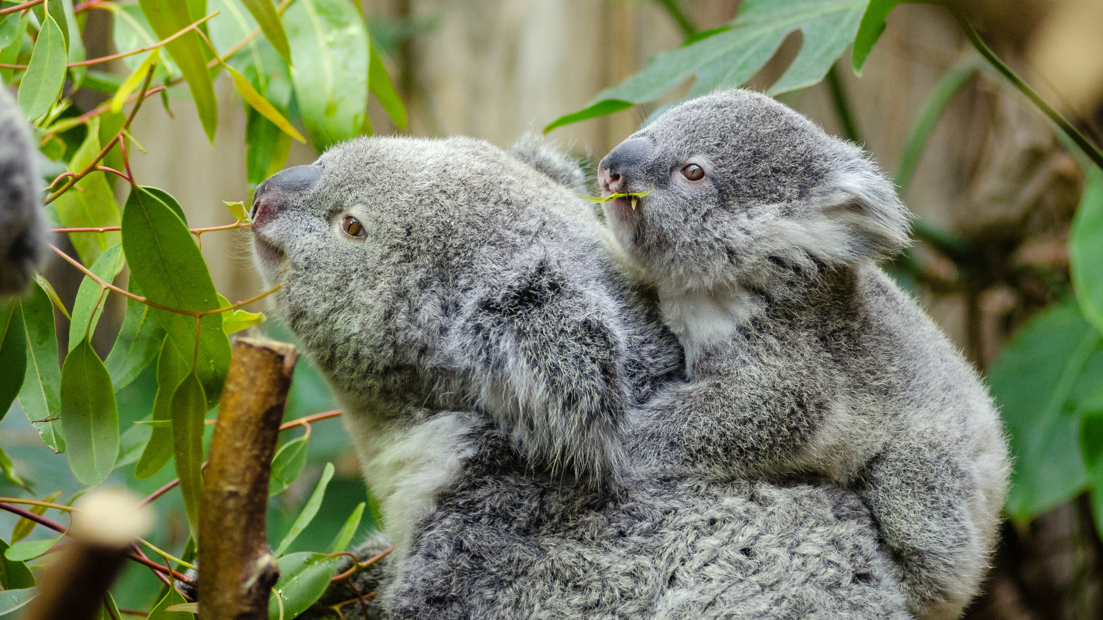
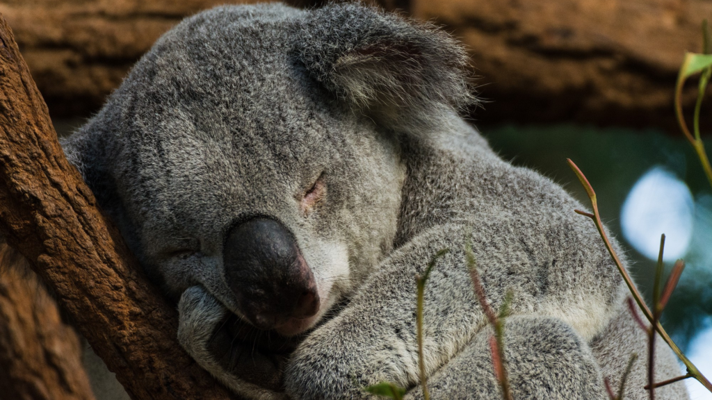
Did you know? Why the Koala is more than just an icon
The Koala is one of Australia’s most beloved and globally recognised animals; a true cultural icon symbolising the unique natural heritage of this land.
But the Koala is much more than just a cuddly mascot: it is a demonstrated ecological indicator of ecosystem health.
Where Koala populations are stable and healthy, it signals that the basic ecological and genetic processes that support all flora and fauna (including humans) in the landscape retain some function. In other words, Koalas give us a window into the wellbeing of the environment itself.
The Unseen Koalas: Populations Yet to Be Mapped
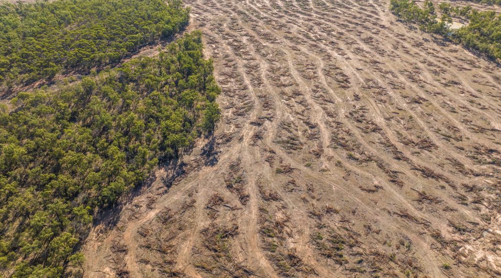
Despite their iconic status and ecological importance, the majority of Koala populations surviving today in Eastern Australia remain unmapped. These populations haven’t yet been scientifically identified or described, hence don’t officially exist in land-use and planning or instruments. This comes in sharp contrast with Victorian populations which have been mapped and described.
This lack of recognition of Eastern Australian Koala populations is critical, especially when we consider that Queensland and New South Wales alone clear approximately half a million hectares of native forest annually. This deforestation rate (among the highest in the world), combined with existing unsustainable land uses that began only ~ 150 years ago, is pushing Eastern Australian Koalas towards the point of no return. Which is why the species was listed as Endangered in Eastern Australia in 2022 under federal law.
Without comprehensive mapping of all Koala populations in Queensland and NSW, planning and land-use decisions continue blindly with no understanding as to how these decisions impact the species. This risks not only Koalas but also myriad other species, and ultimately humans who also rely on these ecosystems.
Are Our Conservation Dollars Working?
Each year, tens of millions of dollars of public funding are poured into Koala conservation efforts. Yet the Koala in Eastern Australia is still eroding. Why?
Because many of these investment decisions are currently taken ‘blindly’ with no understanding of their effectiveness, and with no way of scientifically measuring their effectiveness. Worse, blindly investing in some actions can even have detrimental impacts that can fast-track the demise of the species.
For example: if not carefully planned, well-intended revegetation programs that reconnect fragmented landscapes can inadvertently facilitate the spread of deadly pathogens, which can then rapidly spread across the greater landscape.
The challenge is not to halt development: it is to make informed decisions that allow human populations to continue to grow while ensuring we also protect the natural environment that supports us. Sustainable human / Koala cohabitation that allows both species to thrive, means understanding the current Koala population structure across Eastern Australia. This basic scientific data is necessary to allow both:
The effective use of public funding earmarked for Koala conservation, ensuring investments are strategically targeted and measurable in their success; and
Proper, science-based impact assessments to effectively inform planning decisions in the context of proposed developments, including identifying effective mitigation measures.
Mapping Koalas: A Collaborative Scientific Solution
Since the early 2010s, a coalition of academic researchers, independent scientists, government agencies, industry partners, Traditional Owners, NRM groups and citizen-scientists have been working together in an effort to identify, describe, and map all surviving Koala populations across from Victoria to Queensland.
The work in Victoria is completed, and citizen-scientists played a crucial role in theGreat Victorian Koala survey: all four populations currently persisting in the State of Victoria are now identified, mapped and described.
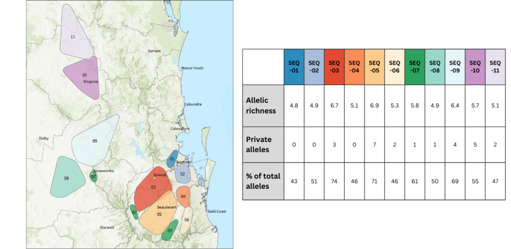
However, the same cannot be said in neither Queensland nor NSW – even though this is where the species is most threatened. The most comprehensive understanding of Koala population structure is currently in Southern Queensland where 11 differentiated populations have already been identified, which is highly concerning. See map image below and check https://doi.org/10.13140/RG.2.2.24954.20163 for further details.
Current understanding of present Koala population structure in Southern Queensland
Why does identifying the currently surviving populations matter?
The natural or historic Koala population pre-disturbance (before European settlement) is known and extensively published. In summary, the Koala naturally occurred in only a few, but very large metapopulations from Victoria to North Queensland.
Comparing the ‘historic’ structure with the ‘current‘ structure, directly allows to scientifically measure how humans are affecting the species since European settlement.
No metapopulation has been identified as persisting today (yet, at least). Instead, the species now occurs in a series of increasingly small, disconnected and isolated ‘clusters’. The more fragmented the landscape has been since European settlement, the more the species is now split into a greater number of smaller clusters.
Without targeted and effective measures to reconnect these clusters, the species rapidly becomes locally extinct. This describes the ‘death by a thousand cuts’ the species is experiencing since European settlement. It is because the species has already become extinct from large parts of its natural range in the last ~200 years alone, and with it vast parts of the ‘genetic code’ that make up the species already lost, that the Koala is now Endangered.
Hence why identifying, mapping and describing all Koala populations that survive today is not merely useful: it is necessary if those that survive today are to persist, in the long term and the short term alike.
It is only if/when a currently surviving population has been scientifically described and ‘put on the map’, that it can be accounted for in planning instruments – and receive the targeted actions it needs to effectively and safely help that population persist.
Because once a population is scientifically confirmed, it gains formal recognition. This means it can be accounted for in land use planning, receive appropriate conservation action, and enable measurable recovery strategies.
What we’re doing
Building on Australia’s largest Koala genetic database, People For Nature now aims to accelerate citizen-science Koala sampling to complete Koala population mapping in Eastern Australia. The approach is:
– Highly optimised and cost-effective
– Rapid and non-invasive: all molecular data (Koala DNA, pathogenic DNA, tree species DNA) required to inform effective management is derived solely from degraded scat / faecal droppings – meaning no disturbance to the animals themselves.
– Scientifically proven, highly scalable, and repeatedly demonstrated through numerous citi-sci projects in Victoria, Queensland and NSW, including multiple projects funded directly by the Federal Government.
– Powered by citizen scientists who are trained and empowered to non-invasively sample their local Koalas themselves
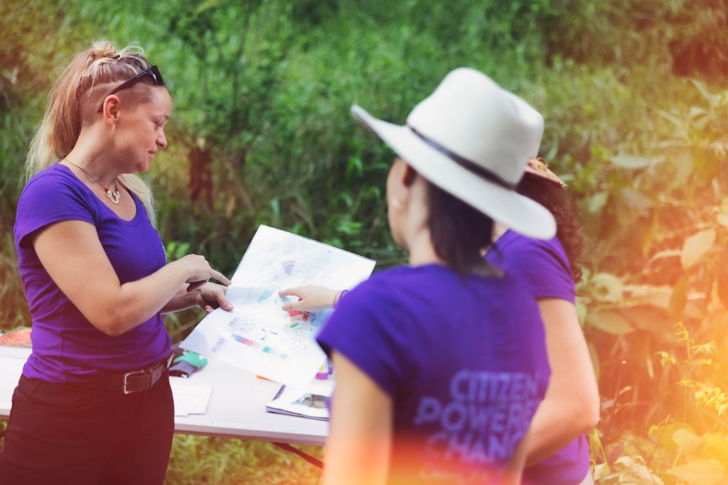
Empowering Communities, Driving Change
People For Nature follows a ‘train the trainer’ model, equipping local communities to become active participants in this collective Koala population mapping exercise. This hands-on involvement not only advances Koala research but also deepens public understanding of Koala population processes, molecular ecology and eDNA technologies, putting communities in the driver’s seat of applied Koala science.
Ecology is often mistakenly viewed as a soft or interpretive science, which has traditionally hindered effective Koala conservation. By contrast, this population mapping effort generates black-and-white scientific data based on lab results from NATA accredited experts – irrefutable scientific evidence that decision-makers can reliably trust and act on.
Why This Matters
Until every surviving Koala population is formally mapped and recognised, land-use and planning decisions will continue to be taken blindly, and investments in conservation efforts will continue to be taken ‘in the dark’, risking being ineffective or even unsafe.
By embracing science, empowering local communities, and investing in citi-sci powered Koala sampling, we can identify and map all surviving Koala populations across Eastern Australia quickly and effectively – thereby giving a chance for those populations to be effectively managed or recovered before these are lost.
How does this citi-sci Koala mapping effort fit into the National Koala Recovery Plan?
This work, and the database it contributes to, was purposely designed with this in mind from inception some 15 years ago. Anyone can contribute to it, including citizen-scientists collecting scat from their local Koalas, and anyone can access the samples or the isolated DNA or the data derived. It directly informs managers and decision-makers, and continuously supports R&D by many academic researchers and a range of scientific organisations.
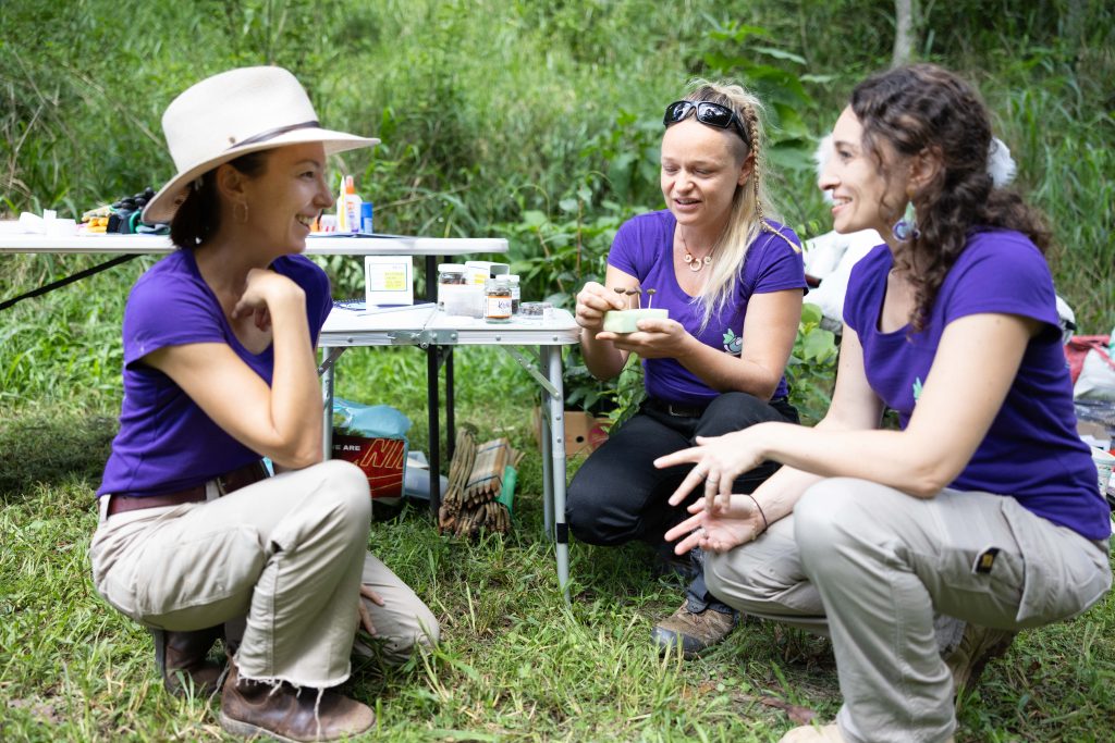
2 – Engage & partner with the community
People For Nature seeks specifically to engage and empower citizen-scientists to collect scats from ‘their own’ local Koalas across Eastern Australia. This is community engagement at its very core.
3 – Increase the area of protected habitat
Empowered with robust scientific data, decision-makers can make effective and targeted investment decisions in habitat protection that meet the specific needs or identified populations. Simultaneously, once a population has been scientifically described and ‘put on the map’, local communities can also advocate for the improved management and conservation of those populations.
4 – Integrate Koala conservation into policy, statutory maps and land use plans
The scientific data obtained enables us to achieve this strategically and effectively – and provides a means to scientifically measure & continuously monitor the success of such plans and policies, to ensure the investment is effective.
5 – Strategically restore Koala habitat
This work directly informs any kind of effective strategy, including the strategic restoration of Koala habitat. Moreover, it also provides the critical pathogenic data (prevalence and distribution of known problematic pathogens) that is needed to ensure habitat restoration is done safely without risking spreading deadly diseases across the landscape.
6 – Actively manage Koala metapopulations
This strategy requires understanding the current Koala population structure across Eastern Australia, which is at the very core of this mapping exercise. To date, no surviving metapopulation has been identified yet as persisting in Eastern Australia. However, several ‘genetic reservoirs’ of critical national significance for the species have already been identified, and several others that are of regional importance. There are likely more populations that are reservoirs of national or regional significance that persist today in Eastern Australia, but are yet unmapped. Identifying all such populations is critically urgent if the species is to have a chance at persisting in the wild in Eastern Australia, and is naturally a key priority of this citi-sci Koala population mapping exercise.
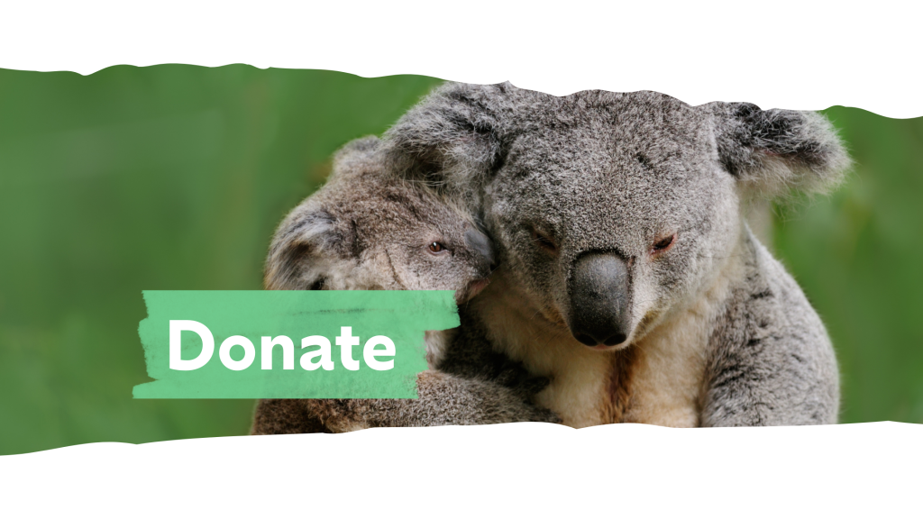
Want to help?
Join us in putting Koalas on the map — through citizen science, eDNA, and a shared vision for a future where Australia’s icon thrives.
Your donation will support our community-driven koala genetic monitoring program. By empowering people power, we collect vital data to protect koalas and their habitats. Every dollar is used efficiently to maximise conservation impact.